Punjab Newsline | Chandigarh
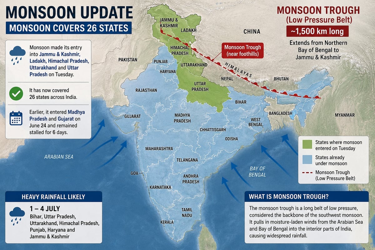
Monsoon made its entry into Jammu & Kashmir, Ladakh, Himachal Pradesh, Uttarakhand, and Uttar Pradesh on Tuesday afternoon, bringing the total coverage to 26 states across India. Earlier, it had reached Madhya Pradesh and Gujarat on June 24 but remained stalled for nearly six days, leading to persistent heat and humidity in several regions.
Meanwhile, relief is expected for Delhi and other parts of North India. Satellite imagery has shown the formation of a nearly 1,500 km-long monsoon trough, extending from the northern Bay of Bengal to Jammu & Kashmir.
According to the India Meteorological Department (IMD), the monsoon trough has formed but is currently positioned near the Himalayan foothills. As it gradually shifts southwards toward its normal position, states including Bihar, Uttar Pradesh, Uttarakhand, Himachal Pradesh, Punjab, Haryana, and Jammu & Kashmir are likely to receive heavy rainfall between July 1 and July 4.
The monsoon trough is a long belt of low pressure, often referred to as the “backbone” of the southwest monsoon. It helps transport moisture-laden winds from the Arabian Sea and the Bay of Bengal into the interior parts of the country, triggering widespread rainfall across various regions.