Punjab Newsline | Ludhiana
By : Amanpreet Kaur Bajwa
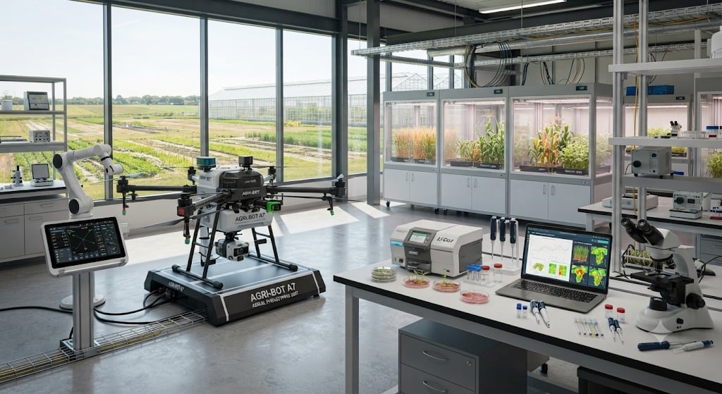
Punjab is moving towards technology-driven agricultural research, with Punjab Agricultural University (PAU) planning to acquire advanced equipment, including a multispectral survey and mapping drone, to improve crop monitoring, field assessment and scientific research.
The proposed purchases include a multispectral drone estimated at ₹15 lakh, an Electronic Total Station costing ₹9.20 lakh and a field-portable UV/VIS/NIR Spectroradiometer estimated at ₹65 lakh. The combined estimated cost of the three equipment items is ₹89.20 lakh.
The equipment is expected to strengthen research in agricultural engineering, land surveying, crop assessment and the study of plant and soil characteristics.
How Will Multispectral Drone Technology Help?
Unlike conventional cameras that primarily capture visible light, multispectral cameras record information across different wavelength bands. Researchers can analyse this data to generate vegetation indices and assess crop health, plant vigour and variations across agricultural fields.
The technology can help identify areas showing signs of crop stress, uneven growth or potential problems related to water and nutrient availability. It will allow researchers to assess field conditions through digital and spatial data rather than relying solely on physical inspections.
Drone-Based Mapping for Detailed Field Assessment
The multispectral survey drone can capture aerial images linked to geographical coordinates. These images can subsequently be processed into digital maps, allowing researchers to study different sections of agricultural land.
Repeated surveys can also help track changes in crop conditions over time and support research related to crop development, irrigation planning and precision agriculture.
Electronic Total Station for Accurate Land Surveys
The Electronic Total Station is an advanced surveying instrument used to measure distances, horizontal and vertical angles, and geographical coordinates.
It can support accurate land surveys, field mapping and topographical measurements. Its applications in agricultural engineering may include land levelling, irrigation planning and drainage-related studies.
Spectroradiometer to Study Plant and Soil Characteristics
The field-portable UV/VIS/NIR Spectroradiometer will help researchers measure reflected light across different wavelength ranges.
The instrument can be used to study how plants, soil and other materials interact with light, providing valuable information about vegetation characteristics, crop conditions and environmental factors affecting agricultural productivity.
Can Technology Help Reduce Farming Costs?
Precision agriculture technologies can help identify variations in crop conditions and support more targeted decisions regarding irrigation, fertiliser application and crop protection.
When combined with soil testing, weather information and other agricultural data, such technologies may help improve the utilisation of farming resources.
However, the proposed PAU initiative is primarily aimed at scientific research and field surveying. It does not automatically mean the introduction of a statewide drone service for farmers.
Survey Drones Different from Spraying Drones
Multispectral survey drones are primarily designed to collect agricultural data, whereas spraying drones are used to apply approved crop-protection chemicals and other permitted inputs over designated areas.
Spraying drones can help reduce the time required for certain agricultural operations and limit operators' direct exposure to chemicals when appropriate safety protocols are followed.
Similarly, mechanised residue-management equipment, including balers and straw-management machines, can support paddy straw management. Digital monitoring systems may further improve the planning and tracking of agricultural machinery and residue-management operations.
Five Key Highlights
1. PAU plans to acquire a multispectral survey and mapping drone worth an estimated ₹15 lakh.
2. An Electronic Total Station costing ₹9.20 lakh will support accurate land surveys.
3. A field-portable spectroradiometer estimated at ₹65 lakh will help study plant and soil characteristics.
4. The combined estimated cost of the three equipment purchases is ₹89.20 lakh.
5. The initiative is expected to strengthen agricultural research and support the development of precision-farming techniques.